A 4-Day Hike Itinerary in the Japanese Alps
Recently, my friend and I planned a six-day traverse through the Northern Japanese Alps that started in Nagano prefecture and ended in Toyama prefecture. Our plan was to traverse the Northern Japanese Alps, south to north. We started at the trailhead for Mt. Tsubakuro, a popular day hike and starting point for the busy Omoteginza Route, though you could start from a number of other points such as the small city of Kamikochi, Nagano, which is another well-suited (and busy) point to begin hiking.
The idea was to end on Mt. Tsurugi, one of the tallest mountains in Japan and arguably one of the more dangerous climbs, but weather forced us to descend early at Mt. Yakushi on our fourth day, about 23 kilometers south of that point. Here's what our final route looked like.
Day 1: Nakabusa Onsen Trailhead to Daitenso Hut
9 kilometers, 1,660 meters total elevation gain
Day 2: Daitenso Hut to Sugoroku Hut
15 kilometers, 1,200 meters total elevation gain
Day 3: Sugoroku Hut to Yakushi Pass Campground
18 kilometers, 1,190 meters total elevation gain
Day 4: Yakushi Pass Campground, Mt. Yakushi, Oritate Trailhead
13 kilometers, 690 meters total elevation gain
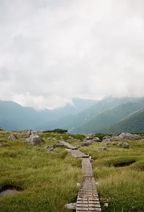
While the major peaks we crossed—Mt. Kurobegoro, Mt. Yari, Mt. Yakushi—were obscured by cloud cover when we reached the summits, Japan's weather gods did grant us a few bits of sunshine and views throughout the hike. We had plenty of wildlife encounters too, including some close calls with mountain monkeys that were not so happy that we were hiking through their territory. We also came across some raicho, which translates to “thunder bird” in Japanese. They are a type of mountain grouse and it's said to be lucky if you catch a glimpse of one. Unfortunately, that luck didn’t translate to better weather conditions for us!
Scroll on below for more film photography from our hiking trip in the Japanese Alps.


